
Interactive Guides to Abandoned Places
Stop Wandering Backroads Hoping to Find Something Photogenic
You’ve driven for hours, searching for that perfect abandoned church or weathered grain elevator you saw in someone’s photo. But without exact locations, you waste precious shooting time, burn expensive gas, and often go home empty-handed.
There’s a better way.
What You Get With Our Interactive Field Guides
Our Abandoned Atlas Photography Field Guides give you everything you need to discover and photograph dozens of abandoned and forgotten places across North America – without the guesswork, wasted time, or frustration.
INSTANT NAVIGATION
Tap any GPS coordinate in the PDF and Google Maps opens automatically with the exact location. No more copy/pasting coordinates or getting lost on unmarked county roads. One tap and you’re navigating directly to your next shot.
VISUAL TRIP PLANNING
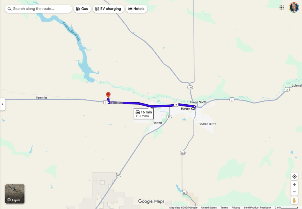
See all locations on an interactive Story Map before you even leave home. Identify clusters of nearby sites, optimize your driving route, and plan multi-day photography adventures efficiently. Click any pin to see photos, descriptions, and GPS coordinates.
SHOOT AT THE RIGHT TIME
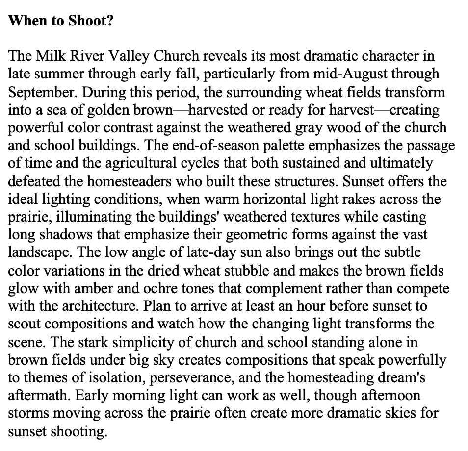
Every location includes recommended shooting times based on light direction and conditions. Know whether to arrive at sunrise for dramatic side-lighting or golden hour for warm glows on weathered wood. Stop showing up at noon wondering why your photos look flat.
UNDERSTAND WHAT YOU’RE PHOTOGRAPHING
Each location includes historical context – when it was built, what happened there, why it was abandoned. Your photos will have meaning and story, not just pretty decay. Share the history with your audience.
PROFESSIONAL COMPOSITION GUIDANCE
Get specific tips for shooting each structure – recommended angles, interesting details to capture, composition suggestions based on the architecture. Learn from someone who’s already shot and studied each location extensively.
KNOW BEFORE YOU GO
Access and safety information for every site. Know which locations require permission, which are visible from public roads, and which have hazards to watch for. Photograph responsibly and safely.
WORKS EVERYWHERE
Interactive PDF works on your phone, tablet, or computer. Download it before your trip and use it completely offline in remote areas with no cell service. The Story Map works online for planning at home or in town.
Who These Guides Are For
LANDSCAPE PHOTOGRAPHERS who want unique subjects beyond the same tourist locations everyone shoots
TRAVEL PHOTOGRAPHERS seeking authentic Montana experiences and one-of-a-kind portfolio pieces
URBAN EXPLORATION ENTHUSIASTS documenting abandoned architecture and rural decay
HISTORY BUFFS interested in Montana’s homesteading era, ghost towns, and forgotten communities
ROAD TRIPPERS wanting to discover hidden gems along Montana’s backroads
LOCATION SCOUTS needing specific GPS coordinates for film, video, or commercial projects
The Problem With Other “Guides”
Most photography location “guides” are blog posts with vague directions (“head west on County Road 12 for about 10 miles…”), low-resolution photos, and no planning tools. You waste hours trying to find places that may not even exist anymore.
Our guides are different:
- Exact GPS coordinates verified on-site (not guessed from satellite maps)
- Interactive Story Map shows everything visually
- Professional photography proves these locations are photogenic
- Updated regularly as conditions change
- Created by a photographer for photographers
How It Works
1. PURCHASE & DOWNLOAD
Buy once, own forever. Instant PDF download to any device. Story Map link included on first page.
2. PLAN YOUR ROUTE
Open the interactive Story Map on your computer or tablet. See all locations at once. Click pins to preview photos and read descriptions. Plan your shooting route based on geography and your available time.
3. NAVIGATE IN THE FIELD
Open the PDF on your phone. Find the location you want to shoot. Tap the GPS coordinate. Google Maps opens automatically and navigates you directly to the site. No signal? The PDF works completely offline.
4. SHOOT WITH CONFIDENCE
Arrive knowing the best time of day, recommended angles, and historical context. Reference the guide while you’re there for composition tips and interesting details to capture.
5. CREATE MEANINGFUL WORK
Share your photos with the stories behind the locations. Your audience connects with the history and meaning, not just pretty images of decay.
Available Regions
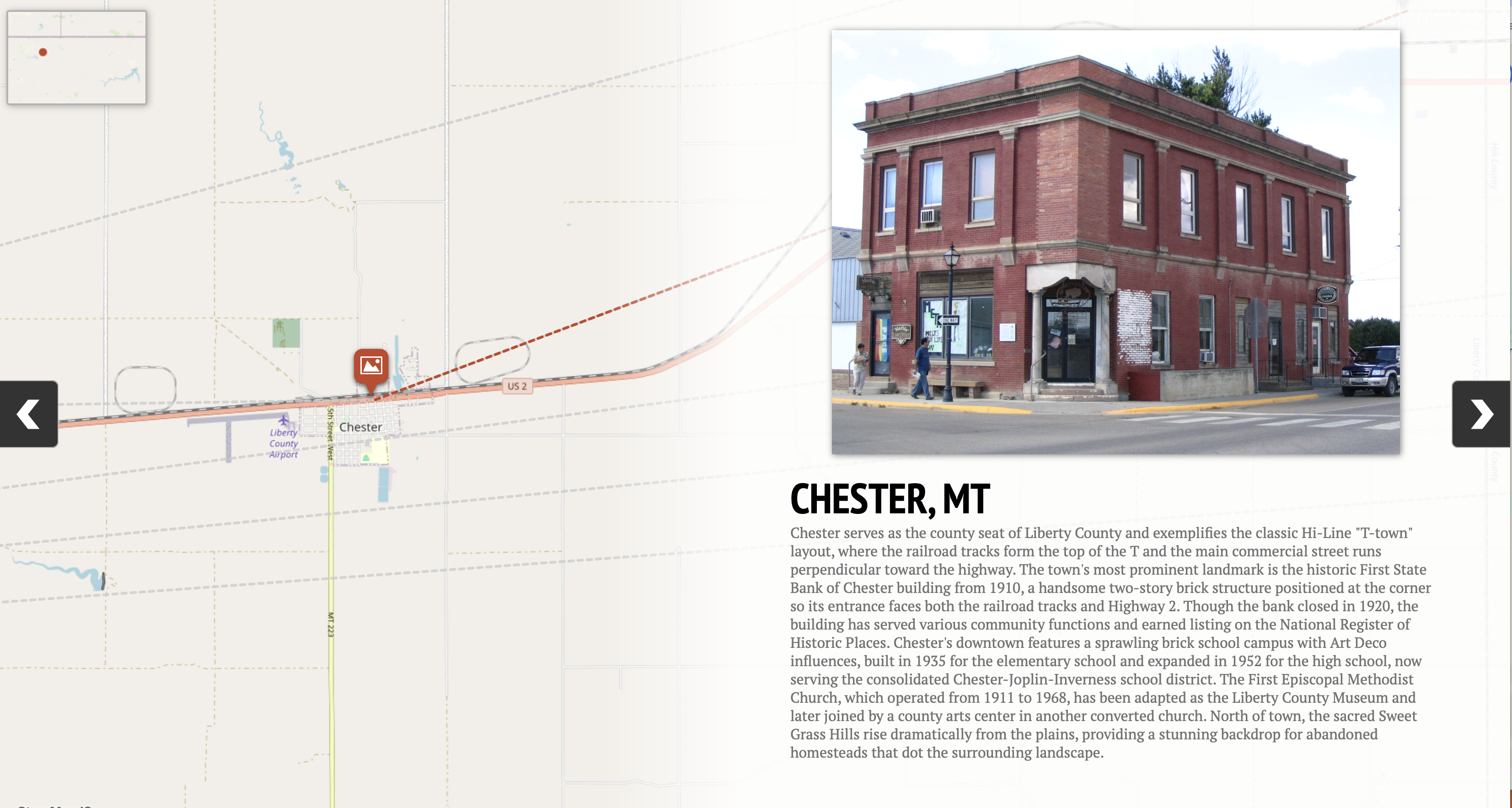
Montana Hi-Line Photography Field Guide
Northern Montana from the Canadian border south. Wide open prairie, isolated communities, dramatic skies. 24 meticulously documented abandoned churches, grain elevators, schoolhouses, and ghost towns.
Central Montana Photography Field Guide
Montana’s heartland including the Judith Basin and surrounding regions. Rolling hills, agricultural history, forgotten towns. 15 carefully selected locations ranging from nearly intact to advanced decay.
Bundle & Save
Get both guides (39 total locations across two distinct Montana regions) and save $7. Cover more ground, shoot more variety, explore Montana’s diverse forgotten places from the prairie to the mountains.
The Abandoned Atlas Difference
PERSONALLY VISITED:
Every location has been photographed and documented on-site. No armchair research or satellite map guessing.
CONSTANTLY UPDATED:
Story Maps updated as conditions change. Structures collapse, access changes, new locations discovered.
PHOTOGRAPHER CREATED:
Made by a photographer who understands light, composition, and what makes a location worth shooting.
ETHICALLY DOCUMENTED:
Respect for private property, historical significance, and rural communities guides everything we do.
QUALITY GUARANTEED:
If you have any issues accessing or using your guide, we’ll help you immediately. Your satisfaction matters.
What Photographers Are Saying
“I used to drive around hoping to stumble on interesting places. With this guide, I shot 12 amazing locations in one weekend. The GPS coordinates were perfect, and the historical info made each place meaningful. Worth every penny.” – Sarah M.
“The Story Map changed everything. I could see all the locations, plan my route, and maximize my shooting time. The composition tips helped me get shots I never would have thought of.” – James R.
“Finally, a guide that actually delivers what it promises. Exact coordinates, real information, and locations that are genuinely photogenic. This is how all photography guides should be.” – Michael T.
Ready to Stop Searching and Start Shooting?
Choose your region below and start exploring Montana’s forgotten places today. Instant download, lifetime access, works on any device.
Every guide comes with our satisfaction guarantee – if you have any issues, we’ll make it right.
[Shop Montana Hi-Line Guide (24 Locations) – $27]
[Shop Central Montana Guide (15 Locations) – $27]
[Shop Both Guides Bundle (39 Locations) – $47]
Frequently Asked Questions
Start exploring Montana’s forgotten places today. Your best photography adventures are waiting.