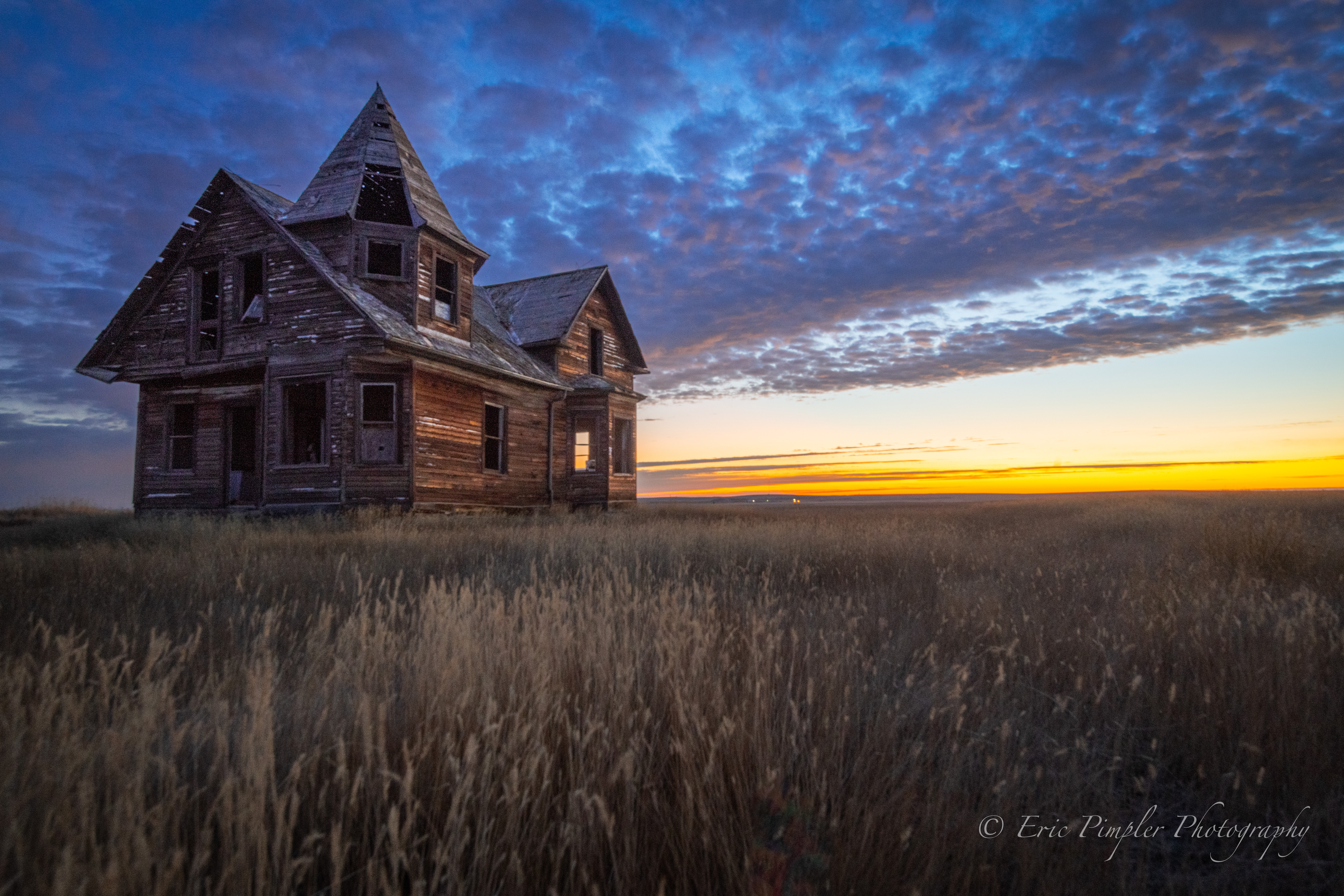
Nestled in the rolling plains of southern Saskatchewan, near the town of Shaunavon, stands an enigmatic structure known locally as “The Witch’s House.” This abandoned farmhouse, with its distinctive turret and weathered facade, has long captivated photographers and history enthusiasts alike. The house’s unique architecture, particularly its turret, evokes imagery reminiscent of witchcraft and folklore, earning it its eerie moniker. I first learned about this house from Chris Attrell’s YouTube page.
The history of the Witch’s House is pieced together from personal memoirs and local historical texts. According to Therese Lefebvre Prince’s 1989 memoir, the house was originally built on T. St. Hilaire’s homestead and later sold to Dave Pattyn in 1918. In the 1940s, it became home to Mr. and Mrs. Robert Desautels. The local history book, “Quarter Stake Echoes,” offers a slightly different account, leading to some mystery about its origins. Despite these discrepancies, both sources point to the house being an enduring, if enigmatic, relic of the region’s early settlers.
Many of the original prairie homes originated as catalogue houses. Landowners could order blueprints and, depending on the company, also receive all necessary construction materials, including lumber and fixtures. Once delivered, these kits made it easy for settlers to quickly start building, with only the need to begin hammering nails. Perhaps this was the origin of the “Witch’s House”?
You can read more about the history of this house in Glen Bowe’s excellent article.
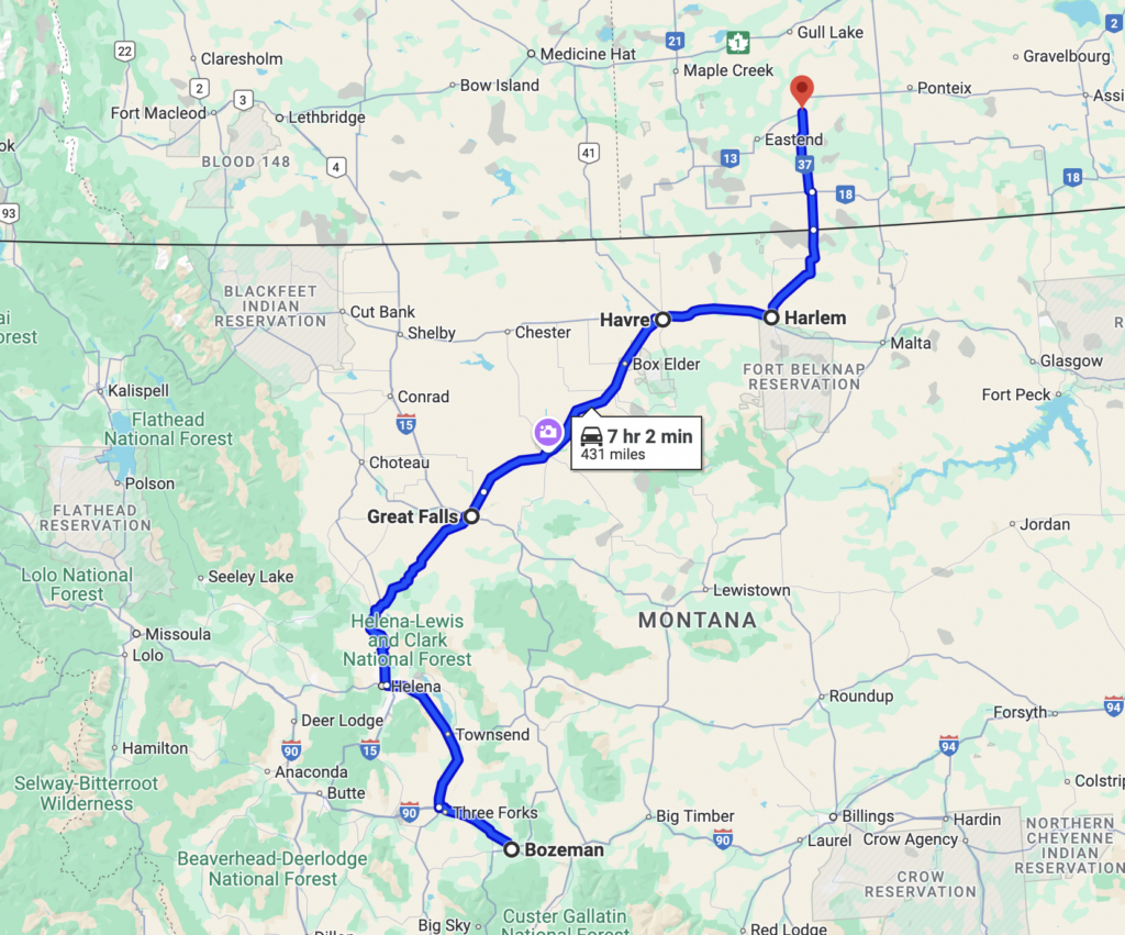
In early October, I embarked on a photography trip to this location, hoping to capture the essence of “The Witch’s House” amidst the changing autumn landscape. My trip began with a flight from San Antonio to Bozeman, MT. After a day of driving and occasional photography stops through central Montana (I’ll detail some of these stops in future articles) I arrived in Great Falls, MT where I spent the night. From Great Falls I made my way up and across a section of the Montana Hi-Line (US Highway 2) through Havre and then north on Highway 241 at Harlem. I entered Canada at the Climax border crossing on CA 37. You can see my full route from Bozeman to Shaunavon below.
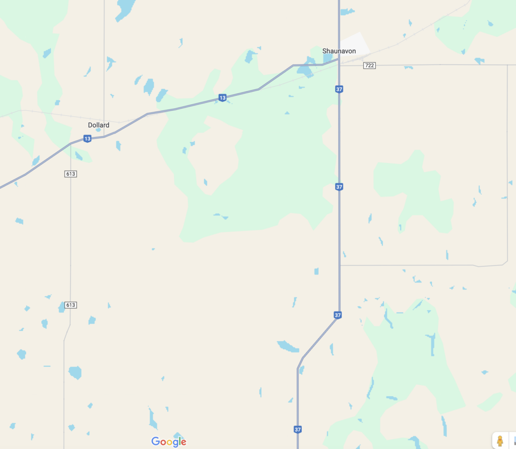
I’ve chosen not to share the exact coordinates or driving directions to the Witch’s House in this article. However, if you’re genuinely interested in visiting, feel free to reach out via email or direct message, and we can discuss further. This site is a delicate piece of history, and I prefer to keep its precise location private to help protect it from potential vandalism. However, the general location of the property is within the map area below.
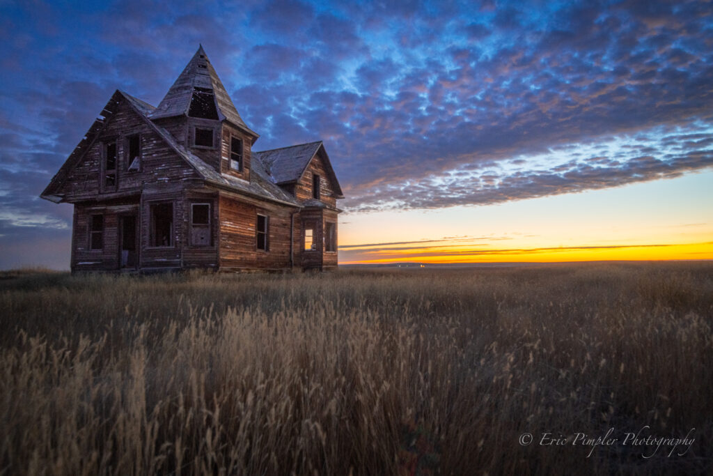
The weathered wood of the structure contrasted beautifully with the golden hues of the surrounding prairie grass, and the overcast sky added a touch of drama to the scene. My favorite shot from the trip to the house is below. It was captured at sunrise on a cold (23 degrees Fahrenheit) October morning. I seriously detest early mornings and cold weather, but this shot was well worth the 5:00 AM wakeup call! This shot highlights the house’s iconic turret framed against the backdrop of rolling clouds, emphasizing the mystery that has drawn visitors to this site for decades.
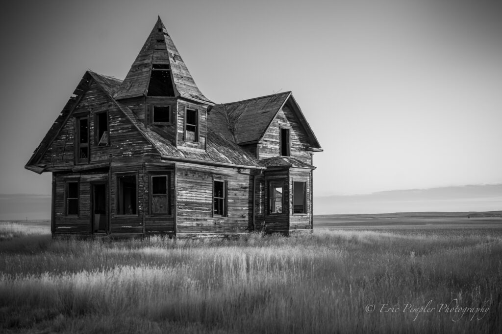
Another image captures the intricate details of the aging structure, telling the story of time passing in this forgotten place.
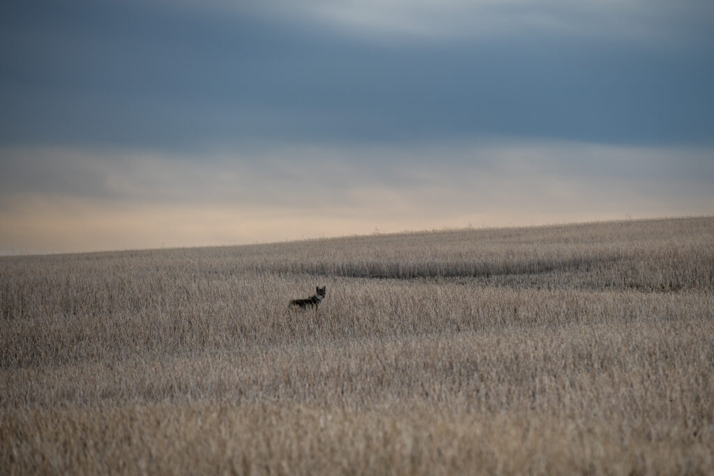
The surrounding landscape of southern Saskatchewan is characterized by its vast prairies and gently undulating terrain. This region is part of the Prairie Ecozone, which encompasses grasslands, aspen parklands, and montane forests. The area is known for its fertile soils, making it one of the world’s great wheat-producing regions. Economically, southern Saskatchewan has traditionally been dominated by agriculture, with wheat, canola, and barley as primary crops. In recent decades, the extraction of oil and natural gas has also become a significant contributor to the local economy. Evidence of significant agricultural activity and oil and natural gas extraction is prevalent across this entire area. However, I saw an abundance of wildlife as well including several coyotes (you can see one that I captured below), deer, antelope, and many bird species.
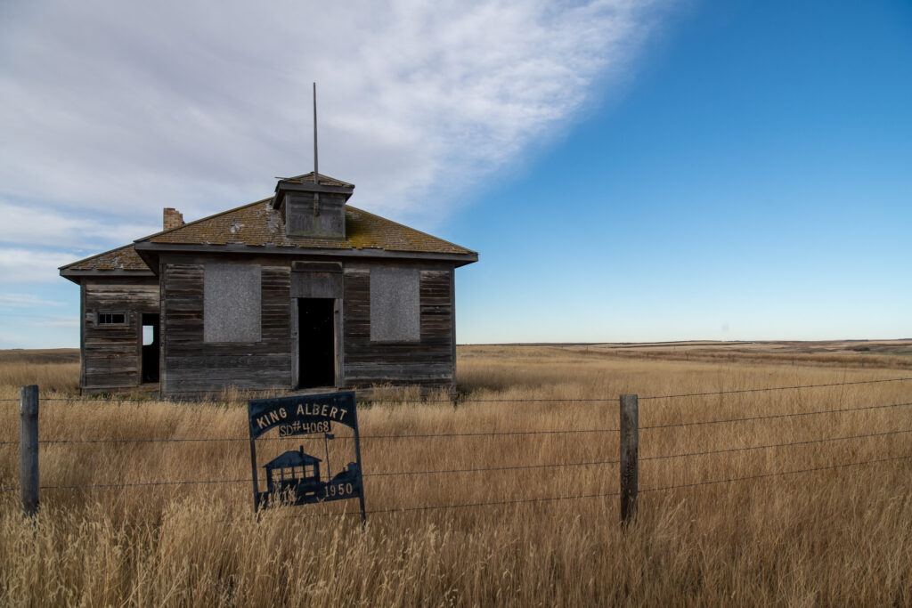
I also found evidence for the location of two schools in the nearby area. Just down the road from the house is a sign that marks the location of the Mine Valley School (1914 – 1945), although the structure no longer stands. You can see a picture of the sign in Glen Bowe’s article (I didn’t take a picture of it). There was also another school a few miles east of the house that is still standing. This is know as the King Albert (1913 – 1950).
Visiting “The Witch’s House” and the surrounding area offers a glimpse into the architectural and cultural history of the early settlers in this region. Its haunting beauty, set against the backdrop of Saskatchewan’s expansive prairies, provides a reminder of the passage of time and the stories embedded in the landscape. For photographers like myself, this location presents an opportunity to capture not just the physical decay of the building, but the evocative atmosphere that surrounds it, especially in the autumn light of October. From Shaunavon I traveled north-east to the ghost town of Neidpath, SK which will be covered in a future article.

